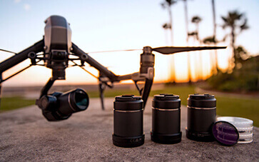
To understand the importance of Drone Mapping, it’s essential to know what it is all about.
Using unmanned or remotely controlled aerial vehicles, drone mapping is a novel and creative way to obtain high-quality, high-resolution images of a specific landscape. These visuals are then layered to create an exact and accurate topography data collection.
Let us at Space Drone, a leading Drone Mapping company in UAE, offer our assistance to create a detailed visual of a terrain.
Due of its many advantages over conventional methods, drone mapping is crucial for modern businesses. Drones’ ability to efficiently gather data over dangerous terrain eliminates the need for personnel to access dangerous areas, increasing safety. This guarantees that surveying can be carried out without endangering employees.
Contents
This technology has revolutionised various industries, including construction, mining, agriculture, and waste management. Due of its speed, accuracy, and efficiency, drone mapping has supplanted labour-intensive and time-consuming traditional surveying methods. Drone mapping simplifies complex processes and provides professionals with valuable information, whether it is utilised for regulatory compliance, worksite progress monitoring, or volumetric measures.
Drone mapping creates an incredibly accurate and scalable image of the terrain by using GPS data and precise measurements.
When field personnel and office staff keep in sync with each other through real-time updates and 3D visualisations, mistakes and misunderstandings are reduced. Additionally, drone mapping optimises resource distribution. Short flight times and efficient data processing result in projects being completed faster, which reduces costs and downtime.
Accuracy is also another important advantage. With its ability to measure to within a tenth of a foot, drone mapping guarantees accurate results.
A drone company focusses in using UAVs for a range of business objectives. These businesses offer services like videography, mapping, aerial photography, and inspection. Drones fitted with sensors and high-resolution cameras are used to collect data that is crucial for sectors like real estate, agriculture, and construction.
Space Drone is a leading name in drone videography and mapping in Dubai and the UAE. As an approved operator by the DCA and GCAA, we specialise in providing unparalleled aerial data solutions tailored to meet the unique requirements of our clients. We also have experience with volumetric measurements, digital surface modelling, and stockpile management. We also provide live streaming services and cinematic drone filming, guaranteeing top-notch video production for TV ads, corporate campaigns, and other events.
We at Space Drone provide services to a diverse range of industries, such as construction, mining, waste management, and environmental monitoring. Not only can our drone mapping solutions save time and money, but they also offer a safer alternative to traditional methods. Our customers rely on us to provide accurate data that enhances project outcomes and makes decision-making easier.
A proficient Drone Videographer in Dubai adds knowledge and accuracy to mapping projects such as these.
For those seeking top-notch drone mapping and videography services in Dubai and the UAE, Space Drone is the best choice. Our team combines technical expertise with a customer-centric approach to guarantee that every project is handled with care and accuracy.
From accurate mapping to stunning videography, our results are exceptional.
Our dedication to quality, safety, and innovation sets us apart.
We remain at the forefront of the business while giving our clients the tools they need to succeed because of our proven track record and dedication to excellence.
For more details, Call us at +971528418204 or email us at info@spacedrone.ae.