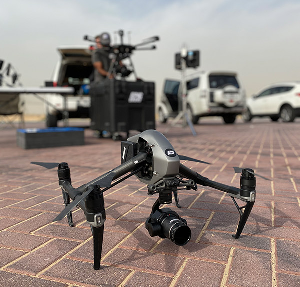
A drone, or commonly known as an unmanned aerial vehicle or a UAV is a type of flying robot that can be controlled remotely or fly autonomously. Initially used by various military organisations around the world, now it has been popularised and is being used in various industries. While the military forces use drones for surveillance, reconnaissance, and targeted strikes, other industries use drones according to their needs.
In today’s technological world drones are used in various industries such as Agriculture, Construction, Mapping, Survey, Power inspection, Environmental monitoring, First response, Photography, Videography, Delivery, Search and rescue and many more.
Contents
So what is Drone Mapping?
The world is moving at a fast pace with all the technologies. New and more innovations are used to improve our living standards and to make our lives easier.
Drone Mapping is such a cutting-edge innovative technique that uses UAVs (Unmanned Aerial Vehicles) to view and record detailed images and videos of construction sites, landscapes, industrial zones and much more. Drones are fitted with high-quality cameras capable of capturing high-resolution visuals from a vantage point.
We at Space Drone are one of the leading Drone Companies in Dubai.
Using advanced photogrammetry software, the visuals captured are processed and stitched together to create a precise 3D model or map of the area. With drones you can get a highly detailed and accurate representation of the site, allowing businesses to gain a clearer understanding of the terrain and to make informed decisions based on real-time data.
We at Space Drone are a professional drone company that is approved by both the Dubai Civil Aviation Authority (DCA) and the General Civil Aviation Authority (GCAA).
The latest technique in aerial photography is drone mapping. Here drones are employed to capture detailed visuals of various kinds of terrain, industrial areas, and building projects. These drones are fitted with high-resolution cameras that allow them to capture multiple pictures from different vantage points.
Drone mapping has become much more in demand in recent years, especially in sectors like urban planning, agriculture, and construction. It is particularly valuable due to its capability to deliver precise data promptly. The precision, efficiency, and cost-effectiveness of drone mapping make it a revolutionary tool for businesses across the UAE.
The advantages of drone mapping can’t be understated, especially in this fast-paced industrial world where time is money. Drones are used for their visual capturing ability, which can’t be achieved using traditional methods. We at Space Drone can cover large areas faster and cheaper using our latest drones than the traditional methods of surveying and mapping. Drone use can improve safety as well because it allows access to hard-to-reach regions without really putting human lives in potentially dangerous situations.
At Space Drone, we don’t just offer drone services—we provide solutions.
We at Space Drone stand out as one of the top Drone Mapping Companies in the UAE.
Our team’s experience and our cutting-edge tools ensure that we meet our clients’ precise mapping needs.
Why Space Drone for Your Drone Mapping Needs in UAE
When you hire a professional drone mapping company in the UAE like us at Space Drone, you gain access to the latest and innovative methods for surveying and data collection.
At Space Drone, we use photogrammetry to create survey reports and site maps. At Space Drone, our services are designed to help clients manage data and make significant choices based on our in-depth analysis and crystal-clear visuals.
Our state-of-the-art drones with highly efficient batteries and extended flight times enable us to capture images over large areas without frequent interruptions. The high-resolution images taken by our drones offer accurate, real-time data crucial for decision-making and project planning.